Monday, 24 November 2014

Day 24 - Monday, November 24, 2014

Stayed out of the woods today for a road hike in West Kelowna.  Now some of you may think this is a part of Kelowna, and you couldn't be faulted for that as this is the name of what we used to call the West Bank or, the other side of the lake from Kelowna. Confused yet? 

Residents of unorganized other side of the lake (West Bank) voted not to become part of Kelowna and established their own town. They gave themselves this unique name - West Kelowna. Wow

Irony: "a state of affairs or an event that seems deliberately contrary to what one expects and is often amusing as a result"

There was irony everywhere in my walk which started by the Friends Pub, weaving towards Thacker Road, across Boucherie to Gregory Road and Mission Hill Winery at the far end of the hike.  Total kms was easy to gauge as this was all on the roads and Google maps says I hiked 14km. Google doesn't take into account the loss and gain of altitude and there was a lot of it today.


Irony was demonstrated early with this sign on the truck which reads "RUN YOU STICK BASTARDS" with a sign just on the other side of the driveway asking for "Caution Children at Play". Makes me wonder how neighbourly this truck driver is.


The irony of this house is that there is more room for the cars/trucks than there is for people. At least it looks that way from the front.


Looking south towards Okanagan Mountain Park, one can clearly see the snow line. 


"Mission Hill presents "Encounters with Iceland,' a major sculpture exhibition featuring 42 life size works of acclaimed Icelandic artist Steinunn Thórarinsdóttir" What is Steinunn trying to say here? 


Ironically, these vines seem to be saying the same thing.


Mission Hill courtyard without the throngs of people usually here. Did not have any wine. Really.


One of the Mission Hill's vineyards on the way towards Mount Boucherie Road. These grapes had not been picked yet.  Waiting for ice wine. 


What it looked like on the other side of the street. Mount Boucherie in the background.


Quail's Gate winery is ready for Christmas. This gives me some perspective that my 30days of walking will soon be finished. Had a little taste of the Chasselas - Pinot Blanc.Delicious at 11:30 am.


Just past Quail's, unpicked grapes.


More irony - this cacophony of farm type buildings stands in stark contrast to most of the housing in West Kelowna. 


On Sunday, I will have hiked for 30 days!

Sunday, 23 November 2014

Day 23 - Sunday, November 23, 2014

We originally thought we'd hike McDougall Rim and around Hayman Lake today, but the weather proved less than cooperative. We also started a little later than usual as this is the day we usually talk to our families in Ontario. 

We hiked around Kalamalka Lake Provincial Park from Cosen's Bay Gate parking lot around The Wall to the Sidewinder Trail and the Cosen's Bay Beach for our lunch. Although this one of our favourite hikes, we haven't been here much this year because of the amount of driving required.  When they come, we take our visitors here. You can be sure to see some deer up close. 

This lake is lovely, a colour of blue/green that you see in the Mediterranean (well, when its sunny it looks that way, but not today.)   Last summer we saw a Western Rattlesnake on this trail as we were getting close to the car. All was quiet in the critter department today except we did see deer. One should worry more about un-exploded ordinances as this area was used for training during WW2.

We started off against the rain/snow, but it cleared up as it does mostly here in the Okanagan.  This is looking east towards the Monashees.

Looking westerly onto Kal Lake, this is at the top of the cliff that I took my good friend Sheila. She's still cursing at me for it. Sorry Sheila.


This is looking east again. 


Another view from the top of the Wall.


The trail as it meanders at the top of the hill.


Looking down towards the end of the peninsula or Rattlesnake Point.


Cactus, because this is a semi-arid area. These sometimes stick into your shoes and they are hard to pick off without gloves.


Looking down to Cosen's Bay, a beautiful sandy beach which you can only get to by walking/cycling or by boat.  I once saw a couple of women take their horses there for a swim, with them handing on and gliding behind. They were really whooping it up.


Cosen's bay closer.


A sea of bulrushes near the beach.  


Those distant hills are always a delicate colour of beige or just green in the spring, almost like a living, breathing hill.


Day 22 - Saturday, November 22, 2014

The weatherman is a bit off, but we're happy for this beautifully sunny morning. Hovering around 0 Celcius, yesterday's clouds are gone.  It's Saturday, so Don is excited about doing a hike and chooses where to go. After pouring over the maps, we agree to drive and park our car at or near the Scenic Canyon Regional Park to eventually hook onto the Greenway.  We'll walk to KLO road and take a bus back up to Gallagher's if the timing works out.

From the top of the hill you can see intriguing Layer Cake Mountain. Don't take my word for it. You should see it yourself.

"Layer Cake Hill, sometimes called Layer Cake Mountain, is a volcanic land form composed primarily of Dacite [day-site], volcanic rock with a high silica content. It shows unique layering that has not been seen anywhere else. 

Although the layers of Layer Cake Hill look like a series of lava flows (volcanic rock), each layer representing a separate flow, modern science has proven this wrong. Scientists now believe that the layering occurred in possibly only one thick volcanic flow due to a peculiar way the rock shrinks as it cools. This type of layered structure has been compared to a similar formation in New Zealand where scientists have thoroughly studied it. Still, Layer Cake Hill is unique in the world!"  from Wikimapia


Layer Cake Mountain across the Mission Creek

Layer Cake Mountain in the background. The trail is well marked and maintained.  Near the Creek, we heard what sounded like thunder, but what must have been a rock falling. It was an incredible noise.


Across the Mission creek, sunlight highlights these eroding banks. 


Many years ago before this set of steps was installed, we dragged our bikes up this steep slope and then coasted all the way down to the pub at McCullogh station.  There is always a reward.


The frozen banks of the Mission Creek from one of the foot bridges.


This is my darling photo of the day. You could almost imagine a Disney sequence here.


Luckily, we were in time for the bus which took us close enough to our car.  I've come to realize that Kelowna is a bunch of farms trying to disguise itself as a city with the highway's strip of commerce, somewhat reminiscent of Canada's population clustered around the 49th parallel. More than likely, it is where I've chosen to walk and my preferences. 

Again, the farmer in me. They looked so healthy!


Saturday, 22 November 2014


Day 21 - Friday, November 21, 2014

I wasn't prepared. That should be the motif for this hike. Wasn't prepared for the snow/rain, wasn't prepared for where to go and how far.  Originally thought I could get to Oliver via the Kettle Valley Railroad from Okanagan Falls. Well, at the south end of Vaseux Lake, the rail bridge was no longer there.  Hmmm, should I continue following a well marked trail and hope to eventually be able to cross the river or do I double back?  With darkness falling earlier and earlier, I chose the best option and doubled back to Okanagan Falls. It took me 2 hours to get to that point, and 1 1/2 hours to come back.  I did not see one person on this hike.
Mea culpa, I will now have a poncho added to my pack.

Even though it was a gray day and cool, the sights were extraordinary, and I will return to this mountainous region of the Okanagan.


Big hills line most of the west side of the hike. 


Looking back at some of those hills.


Just before Vaseux Lake is this very large wetland. Yes, it is French for muddy.


I think these are Trumpeter Swans. There must have been 30 or more in groups making disapproving noises that I was there. Bald eagles and maybe Golden eagles were circling above the American Coots.


More astounding rocks. I've read that there are rattlesnakes in this area, but they were staying warm in their hide y holes.


It cleared up for a while and then the clouds rolled back in for another round of rain and snow.


About 3/4 of the way towards the end of the lake is a giant beaver dam along the lake.


This is the end of the lake and you can see where the bridge used to be, the one I was going to cross. Sheeshh!  By my calculations, I hiked about 18 km.


Thursday, 20 November 2014


Day 20 - Thursday, November 20, 2014

Let me introduce you to Bob, our son's dog. He's a gem. Bob is my dogie alter ego. He loves the woods, loves going for hikes, loves running, loves swimming, has the same hair colour. About the only thing Bob can't do it ride a bike.


If you were hiking in Spain, I bet you might have a glass of wine or two on the trail. I've been planning a wine tour walk, probably from Penticton along the Kettle Valley Rail Trail towards Naramata. I will have to allow for more time if I'm to stop in a few wineries to do some sampling.
In the spirit of honouring Okanagan wineries, today I started my hike on Okanagan Centre Road West, making my way past yet another new development and along the water, back up Camp Road and eventually onto Okanagan Centre Road East.  This brought me past Gray Monk and Nihilo Wineries but there was no imbibing today as I had a schedule to keep.

It's a balmy 0 degrees C, but overcast as it does in the winter. Looking south with yet another development.


The road cuts hard right and left through this canyon going down to OK Centre.


A vineyard planted along the lake. Too bad the sun wasn't shining, but the leaves' coppery colour is quite attractive.


These Okanagan Centre houses near the lake say small town so well. 


Why are these wires hanging so low to the ground?  The hydro crews were asleep when these went up.


Along the road, looking like little round pieces of plastic.


You honestly never know what you'll see next. 


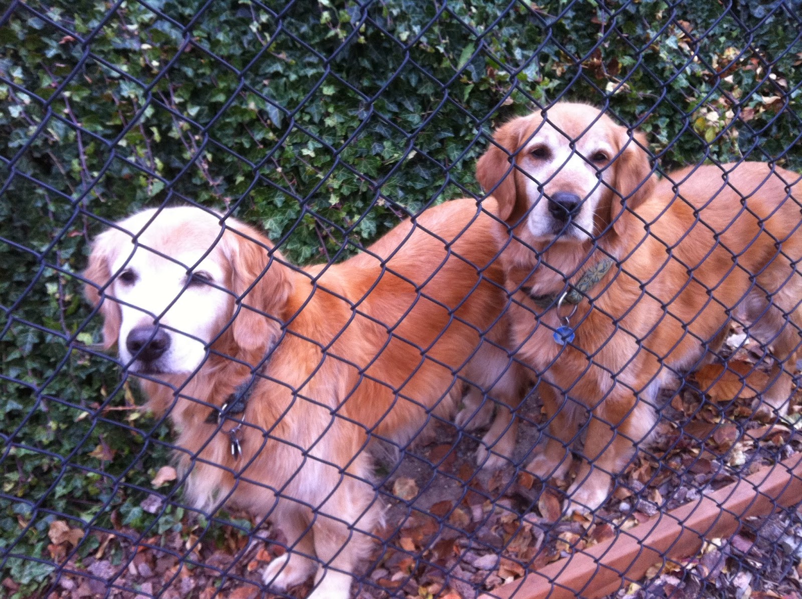
They were more curious than anything else. Didn't even bark.


Great way to get maximum gas mileage. NOT!


I see a trend in the things I see today, or at least that I notice.


This was a giant tree. It was obviously taken down professionally, or, our friend Blake did it.


This photo exemplifies what the area looks like: houses scattered along country roads, orchards and farms.

Looks like a scar on the landscape, but building materials have to come from somewhere. Perhaps the rehabilitation will be a Butchart Garden style transformation. One can hope.